
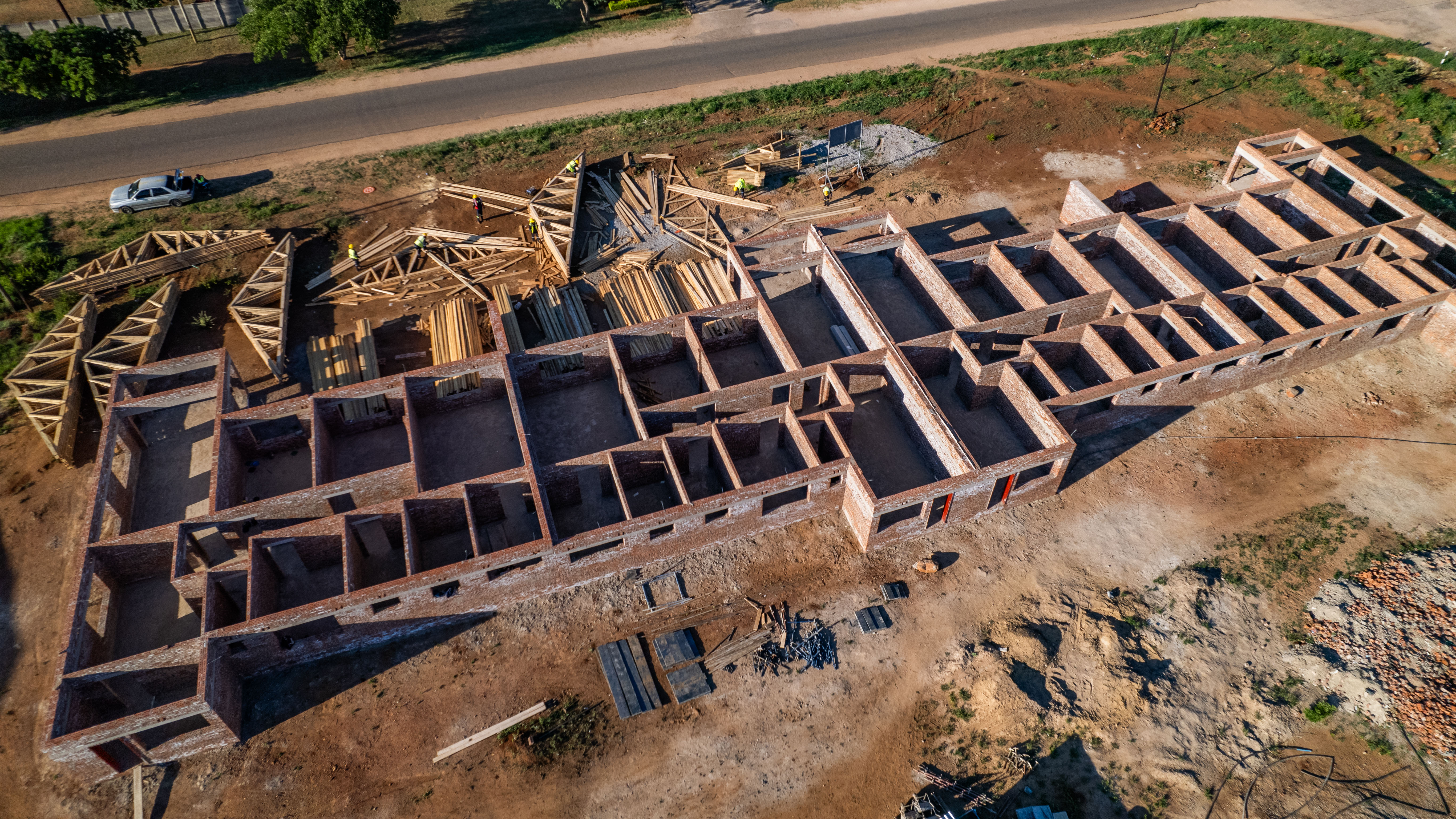
Brief Overview for busy owners and project managers
Monthly drone progress reports include: (1) a dated orthomosaic site map for an overall perspective, (2) detailed annotations for month-over-month comparisons, (3) a short recap video for stakeholders, (4) a shareable and storable PDF, and (5) optional measurements like areas, lengths, and volumes. Turnaround time is usually 48-72 hours after the flight.
Why use drones for progress reporting in Zimbabwe?
Construction sites are spread out, teams are mobile, and decisions need evidence. Aerial reporting from licensed CAAZ pilots delivers a consistent site record without slowing work down. Unlike ground photos, a top-down orthomosaic allows you to view the entire site, assess access routes, and confirm that the planned works are correctly positioned.
Common use cases
- Programme verification: are we on or off schedule?
- Claim support with as-built evidence.
- Remote updates for executives and donors.
- Handover documentation at project close-out.
Standard Monthly Deliverables
- Orthomosaic site map: GeoTIFF and web viewer. A high-resolution, georeferenced map created from hundreds of photos. You can pan and zoom in a web viewer and export snapshots for reports.
- Month-over-month change overlay. Side-by-side or slider comparisons showing what changed since last month, such as new slabs, excavations, roof trusses, or utilities. We annotate the key changes so non-engineers can follow.
- Fixed-point photo set. Photos taken from the same vantage points each month, such as the north gate, admin block, or stockyard, to provide a familiar visual timeline.
- Progress recap video. A quick 30-60 second video that highlights the month's changes, perfect for board packs or WhatsApp updates.
- PDF summary report. A concise, date-stamped report with the best images, annotations, and a short commentary. Ideal for approvals and archives.
- Optional measurements. Areas and lengths for roads, pads, and fencing; contours, DSM, and DTM for planning checks; and stockpile volumetrics with CSV per pile plus cut/fill summary.
Accuracy: relative vs absolute
- Relative accuracy, standard: excellent for visual tracking and approximate measurements. No ground control required, which makes it the fastest delivery route.
- Absolute accuracy, survey-grade: recommended for audited measurements or when designs are tied to coordinates. We lay GCPs to tighten tolerances. We specify the setup in each report so stakeholders know what the numbers mean.
Typical monthly cadence
Week 1: Confirm flight schedule, taking into account weather and site accessibility.
Day 1: Conduct data capture, typically 30-90 minutes on-site for most locations.
Day 2-4: Perform data processing and quality assurance.
Day 3-5: Deliverables include a viewer link, PDF, and recap video.
Optional: A 15-minute review call to discuss any changes.
How owners and project managers utilize the outputs
- Design checks: overlay the orthomosaic in CAD/GIS to verify positions with absolute accuracy jobs.
- Risk reviews: confirm temporary works, access routes, and housekeeping before audits.
- Stakeholder communications: share the recap video and viewer link with no software installs needed.
- Obtain approvals: attach PDF pages and a few labeled snapshots to payment packs.
Site readiness checklist so flights run smoothly
- Confirm access permissions and an on-site safety contact.
- Avoid blasting or heavy crane lifts during the flight window.
- Clear sky or light cloud preferred; avoid rain and high winds.
- If GCPs are required, allow time to place and measure control.
Deliverables and formats at a glance
- Viewer link: pan and zoom web map, with password on request.
- PDF report: highlights, annotations, and month-over-month comparisons.
- Images: JPG/PNG exports for slides or WhatsApp.
- Data, optional: GeoTIFF for ortho, DSM, and DTM; DXF/SHP/GPKG contours; and CSV for volumes and measurements.
Frequently asked questions
How big a site can you cover in one session?
Most construction sites up to about 50 ha are captured in a single visit; larger areas are planned in safe sections.
Will drones disrupt work?
No. We coordinate with your site team, fly outside crane or blast windows, and keep clear of people and plant.
Can you fly in towns or near airports?
We follow CAAZ rules and local by-laws. Some areas require extra approvals, and we handle that in planning.
What if the weather is bad?
We reschedule within the agreed window. Wind and rain degrade image quality; safety comes first.
Pricing and scheduling
Every site is different. Pricing depends on site size, travel, deliverables, and whether absolute accuracy through GCPs is required. Monthly or bi-weekly plans reduce cost per visit.
About Aerial Galaxy
We provide end-to-end aerial data and 360° experiences across Zimbabwe: orthomosaics, DSM/DTM, contours, stockpile volumes, and 360 virtual tours. Flights are conducted by licensed CAAZ pilots. Turnaround is typically 48-72 hours after capture.
Have questions or a site in mind? Request a quote or start a WhatsApp chat and we will pencil in your monthly slot.